Fri, Oct 7, 2016
Next up on our national park quest is Capitol Reef. If you haven’t heard of it, you’re not alone.
The park’s name reflects two of its features. The first is a dome called Capitol Dome for it’s resemblance of US Capitol in Washington, DC.

The second word ‘reef’ refers to the long mesa that blocked travel similar to the way that a reef would block a mariner. So Capitol Reef it is. But how’d that mesa get there?

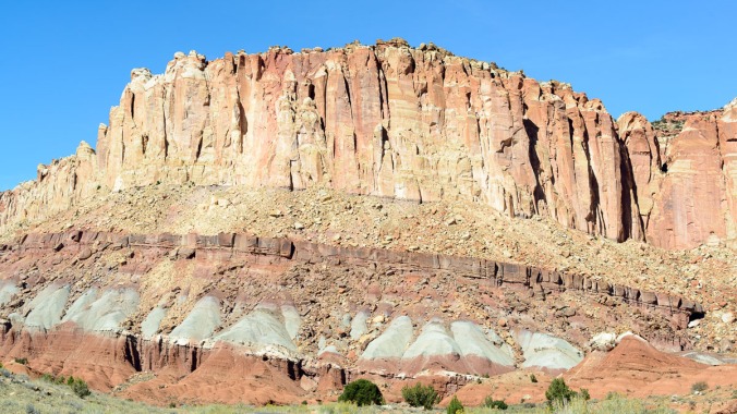
Most people have seen good examples of sedimentation from, for example, hiking in a canyon or along a stream. The beauty depends on the variety of the sedimentation as well as the depth that has been exposed.
The Capitol Reef area was once oceans, deserts and swamps that created 10,000 feet of sedimentary rock. The area also has a fault line that passes through and an uplift event occurred some 50-70 million years ago. The result was that the area to the west of the fault was lifted 7,000 ft higher than the east. But the beauty is that the rock layers folded over the fault line instead of cracking. Subsequent erosion exposed the sedimentary layer and the area is known as the Waterpocket Fold. It’s 100 miles long and blocked travel for the Native Americans, pioneers and ranchers.
How many sedimentary layers do you see in this picture?
Here’s another and the feature on top is known as The Castle.

